Volume 21, Number 1—January 2015
Research
Epidemiology and Ecology of Tularemia in Sweden, 1984–2012
Amélie Desvars, Maria Furberg, Marika Hjertqvist, Linda Vidman, Anders Sjöstedt, Patrik Rydén, and Anders Johansson
Figure 4
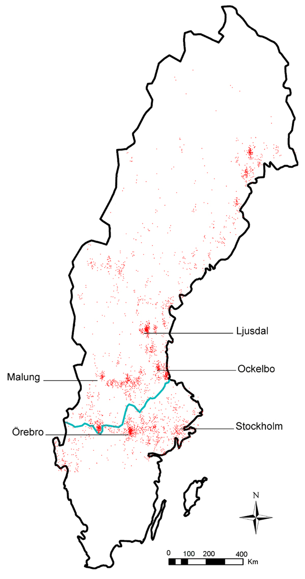
Figure 4. Distribution of 3,524 tularemia cases, Sweden, 1984−2012. Red dots indicate locations of reported cases; blue line indicates border between northern and southern Sweden, as defined by the southern border of the boreal forest. The municipalities with the highest tularemia incidence (Ljusdal, Malung, Ockelbo), and most outbreaks (Örebro) are indicated, as is the capital city of Stockholm.
Page created: December 17, 2014
Page updated: December 17, 2014
Page reviewed: December 17, 2014
The conclusions, findings, and opinions expressed by authors contributing to this journal do not necessarily reflect the official position of the U.S. Department of Health and Human Services, the Public Health Service, the Centers for Disease Control and Prevention, or the authors' affiliated institutions. Use of trade names is for identification only and does not imply endorsement by any of the groups named above.