Volume 28, Supplement—December 2022
SUPPLEMENT ISSUE
Surveillance
Community-Based Surveillance and Geographic Information System‒Linked Contact Tracing in COVID-19 Case Identification, Ghana, March‒June 2020
Ernest Kenu, Danielle T. Barradas, Delia A. Bandoh , Joseph A. Frimpong, Charles L. Noora, and Franklin A. Bekoe
Figure 1
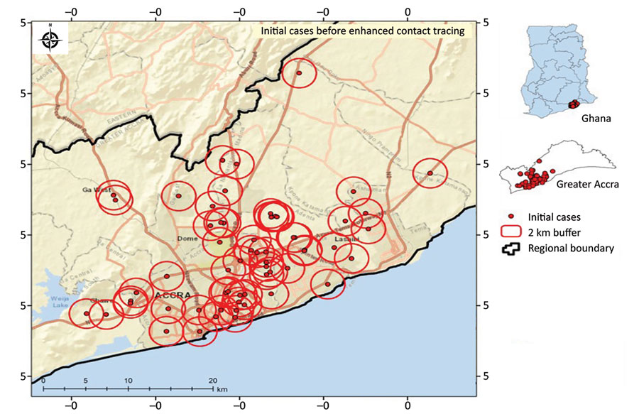
Figure 1. Sample spatial distribution of initial COVID-19 cases defining 2 km buffer around confirmed cases before geographic positioning system‒linked contact tracing, Greater Accra Region, Ghana, March 31, 2022. Insets show location of study area in Greater Accra and of Greater Accra in Ghana.
Page created: October 27, 2022
Page updated: December 11, 2022
Page reviewed: December 11, 2022
The conclusions, findings, and opinions expressed by authors contributing to this journal do not necessarily reflect the official position of the U.S. Department of Health and Human Services, the Public Health Service, the Centers for Disease Control and Prevention, or the authors' affiliated institutions. Use of trade names is for identification only and does not imply endorsement by any of the groups named above.