Volume 29, Number 7—July 2023
Dispatch
Spotted Fever and Typhus Group Rickettsiae in Dogs and Humans, Mexico, 2022
Ricardo Palacios-Santana1, Lihua Wei1, Nadia A. Fernandez-Santos1, Mario A. Rodriguez-Perez1, Sergio Uriegas-Camargo, Nicole L. Mendell, Donald H. Bouyer , and Jose Guillermo Estrada-Franco
Figure
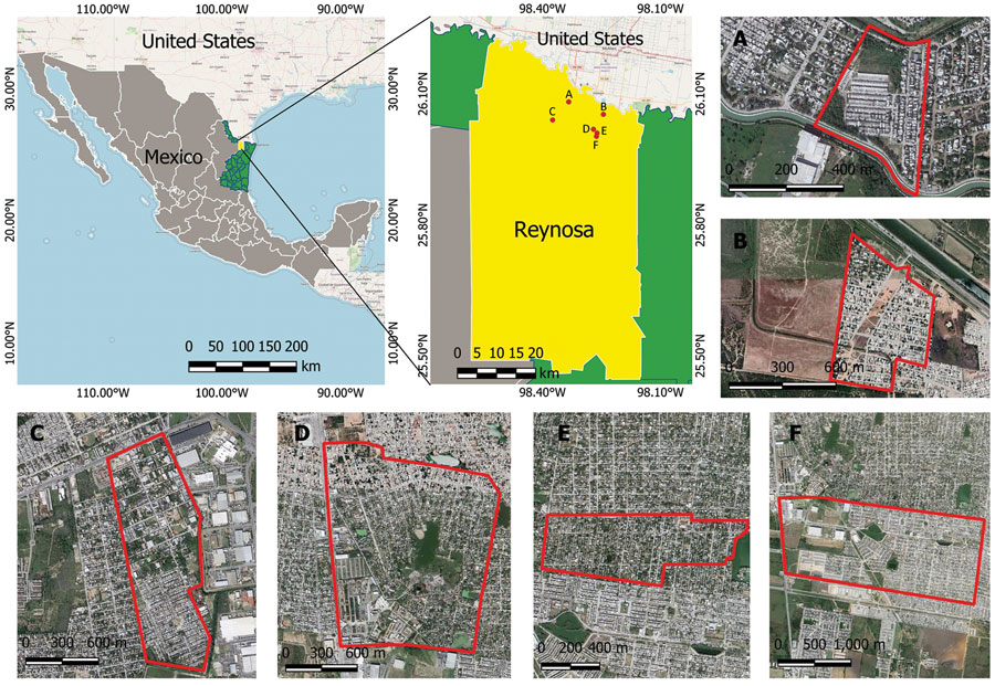
Figure. Sampling locations for study of spotted fever and typhus group rickettsiae in dogs and humans, in Reynosa, Mexico, 2022. Primary maps show location of Reynosa along the Mexico–United States border; neighborhoods sampled (A–F) are labeled and enlarged in the satellite images. Primary maps generated using QGIS 3.28.2 (https://www.qgis.org). Free geographic data of administrative areas of Mexico was downloaded from the National Institute of Statistics and Geography, Mexico (INEGI, https://www.inegi.org.mx/app/mapas). Satellite images and street maps were obtained from Google Maps (https://www.google.com/maps).
1These authors contributed equally to this article.
Page created: May 22, 2023
Page updated: June 21, 2023
Page reviewed: June 21, 2023
The conclusions, findings, and opinions expressed by authors contributing to this journal do not necessarily reflect the official position of the U.S. Department of Health and Human Services, the Public Health Service, the Centers for Disease Control and Prevention, or the authors' affiliated institutions. Use of trade names is for identification only and does not imply endorsement by any of the groups named above.