Volume 15, Number 9—September 2009
Perspective
Using Satellite Images of Environmental Changes to Predict Infectious Disease Outbreaks
Timothy E. Ford , Rita R. Colwell, Joan B. Rose, Stephen S. Morse, David J. Rogers, and Terry L. Yates1
Figure 2
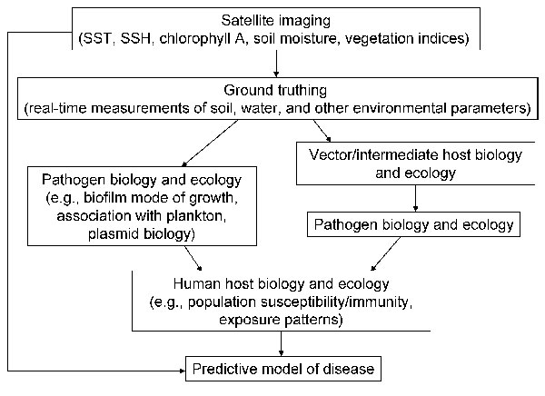
Figure 2. Components of a predictive model of infectious disease based on satellite imaging to assess environmental change. SST, sea surface temperature; SSH, sea surface height.
Page created: December 08, 2010
Page updated: December 08, 2010
Page reviewed: December 08, 2010
The conclusions, findings, and opinions expressed by authors contributing to this journal do not necessarily reflect the official position of the U.S. Department of Health and Human Services, the Public Health Service, the Centers for Disease Control and Prevention, or the authors' affiliated institutions. Use of trade names is for identification only and does not imply endorsement by any of the groups named above.