Volume 11, Number 8—August 2005
Dispatch
Malaria and Irrigated Crops, Accra, Ghana
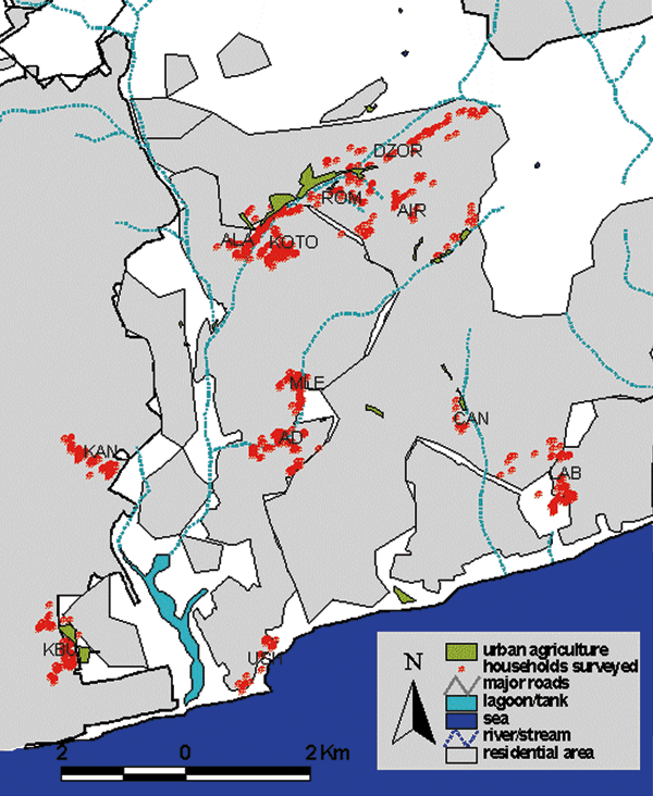
Figure 1

Figure 1. . Location of urban agricultural (UA) sites and households surveyed within Accra, Ghana. Communities surveyed are shown with full name, UA or control (C), number of children sampled, and malaria prevalence. AIR, (Airport, UA, n = 77, 19.5%); ALA, (Alajo UA, n = 166, 15.1%); DZOR, (Dzorwulu UA, n = 132, 19.7%); KBU, (Korle Bu, UA, n = 181, 8.8%); KOTO, (Kotobabi, UA, n = 219, 18.3%); ROM, (Roman Ridge, UA, n = 105, 22.9%); CANT, (Cantonments, UA, n = 23, 13.0%); MLE, (Kokomlemle, C*, n = 160, 20.6%); AD, (Asylum Down, C*, n = 160, 11.3%); KAN, (Kaneshie, C, n = 159, 19.5%); LAB, (Labonie/LA, C, n = 175, 9.7%); USH, (Ushertown, C, n = 200, 6.5%). Communities marked C* were originally identified as control communities but small UA sites were later identified close to them.