Volume 18, Number 9—September 2012
Dispatch
Schmallenberg Virus in Domestic Cattle, Belgium, 2012
Figure 1
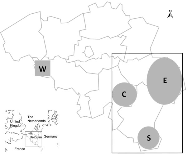
Figure 1. . . Location of 209 farms in Belgium from which 519 pairs of cow/calf serum samples were obtained from blood drawn by field veterinarians in southeastern (rectangle, 195 farms) or southwestern (square, 14 farms) areas in 2012. The area represented by the rectangle is centered on the village of Béthomont (50°08′N, 5°65′E) and measures ≈150 km from north to south and 100 km from east to west. Areas C (center), E (east), and S (south) refer to 3 distinct spatial clusters within the area represented by the rectangle. The area represented by the small shaded square is centered on the village of Taintignies (50°54′N, 3°34′E); each side measures ≈20 km.
1These authors contributed equally to this article.
Page created: August 02, 2012
Page updated: August 02, 2012
Page reviewed: August 02, 2012
The conclusions, findings, and opinions expressed by authors contributing to this journal do not necessarily reflect the official position of the U.S. Department of Health and Human Services, the Public Health Service, the Centers for Disease Control and Prevention, or the authors' affiliated institutions. Use of trade names is for identification only and does not imply endorsement by any of the groups named above.