Volume 15, Number 6—June 2009
Research
Geographic Clustering of Leishmaniasis in Northeastern Brazil1
Albert Schriefer , Luiz H. Guimarães, Paulo R.L. Machado, Marcus Lessa, Hélio A. Lessa, Ednaldo Lago, Guilherme Ritt, Aristóteles Góes-Neto, Ana L.F. Schriefer, Lee W. Riley, and Edgar M. Carvalho
Figure 3
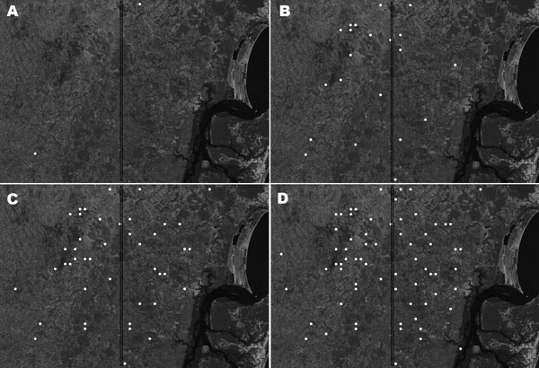
Figure 3. Satellite view of progressive spread of disseminated leishmaniasis in Corte de Pedra, Brazil, 1993–2002. Cumulative distributions of cases within affected areas are indicated by white circles. A) 1993, B) 1993–1996, C) 1993–1999, D) 1993–2002. The vertical line divides the region into inner (left) and coastal (right) areas of similar size.
1Part of this work was presented at the 55th Annual Meeting of the American Society of Tropical Medicine and Hygiene; November 12–16, 2006; Atlanta, Georgia, USA.
Page created: December 08, 2010
Page updated: December 08, 2010
Page reviewed: December 08, 2010
The conclusions, findings, and opinions expressed by authors contributing to this journal do not necessarily reflect the official position of the U.S. Department of Health and Human Services, the Public Health Service, the Centers for Disease Control and Prevention, or the authors' affiliated institutions. Use of trade names is for identification only and does not imply endorsement by any of the groups named above.