Volume 18, Number 4—April 2012
Historical Review
Malaria in Highlands of Ecuador since 1900
Lauren L. Pinault and Fiona F. Hunter
Figure 1
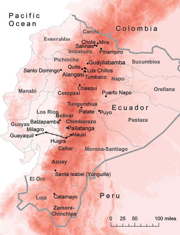
Figure 1. Ecuador showing elevation (red shading), provinces (thin gray lines and boldface), country border (thick gray line), and 15 cities/valleys (black dots). Approximate location of the historic railway between Guayaquil and Alausí is indicated by black railroad tracks, and increasing altitude is indicated by darker shades of red. Map was constructed by using ArcGIS version 10 (ESRI, Redlands, CA, USA).
Page created: March 15, 2012
Page updated: March 15, 2012
Page reviewed: March 15, 2012
The conclusions, findings, and opinions expressed by authors contributing to this journal do not necessarily reflect the official position of the U.S. Department of Health and Human Services, the Public Health Service, the Centers for Disease Control and Prevention, or the authors' affiliated institutions. Use of trade names is for identification only and does not imply endorsement by any of the groups named above.