Volume 27, Number 1—January 2021
Research
Delineating and Analyzing Locality-Level Determinants of Cholera, Haiti
Karolina Griffiths , Kenny Moise, Martine Piarroux, Jean Gaudart, Samuel Beaulieu, Greg Bulit, Jean-Petit Marseille, Paul Menahel Jasmin, Paul Christian Namphy, Jean-Hugues Henrys, Renaud Piarroux, and Stanislas Rebaudet
Figure 2
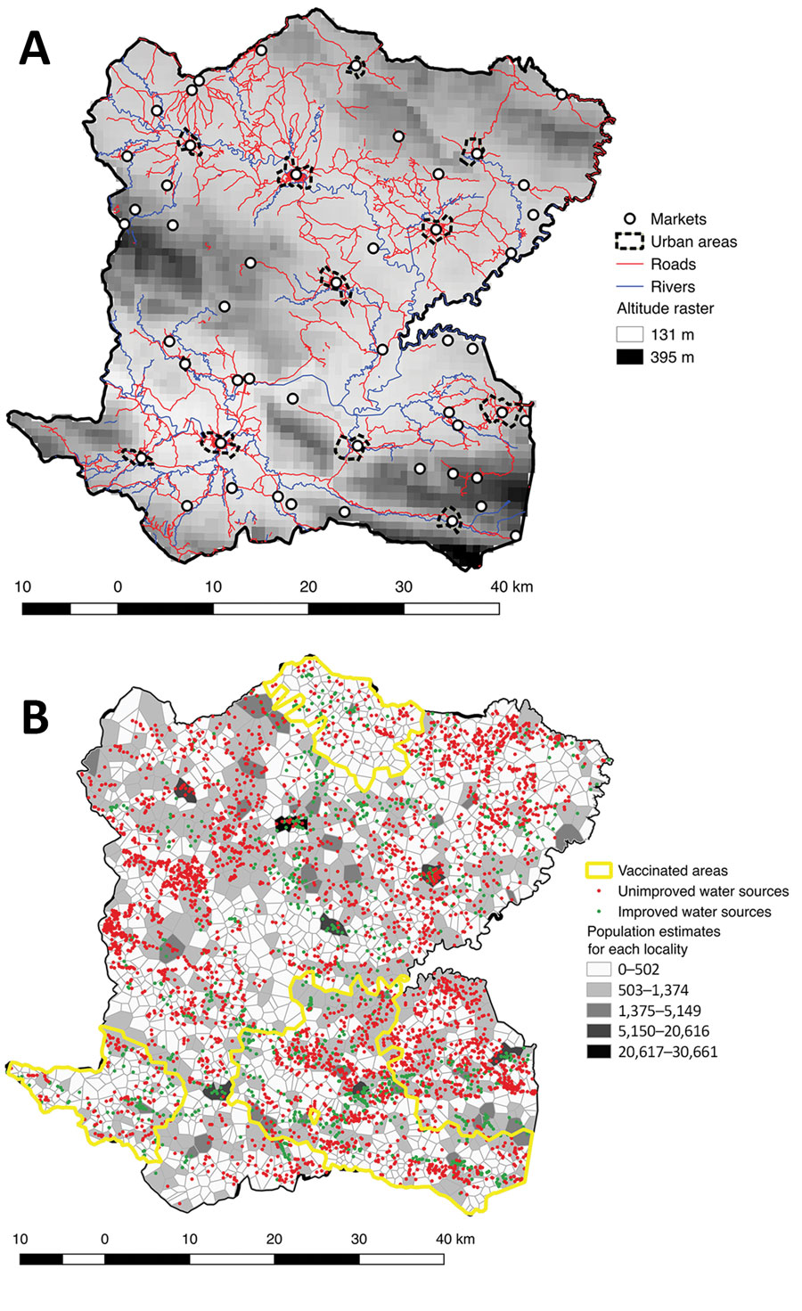
Figure 2. Geographic and demographic details of Centre Department, Haiti. A) Outline of the department’s 12 communes, principal urban areas, altitude raster, rivers, roads, and position of markets. B) Polygon outline and estimated population for each locality, positions of unimproved and improved water sources, and vaccinated areas.
Page created: November 23, 2020
Page updated: December 21, 2020
Page reviewed: December 21, 2020
The conclusions, findings, and opinions expressed by authors contributing to this journal do not necessarily reflect the official position of the U.S. Department of Health and Human Services, the Public Health Service, the Centers for Disease Control and Prevention, or the authors' affiliated institutions. Use of trade names is for identification only and does not imply endorsement by any of the groups named above.