Volume 27, Number 1—January 2021
Research
Delineating and Analyzing Locality-Level Determinants of Cholera, Haiti
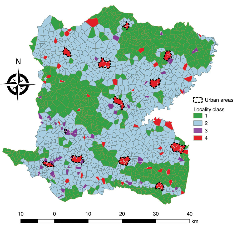
Figure 5

Figure 5. Localities of Centre Department, Haiti, mapped according to hierarchical clustering on principal components classification analysis. Classification analysis determined 2 large lower-risk classes: class 1 localities were remote and higher altitude, and class 2 localities were rural intermediary areas. Two at high-risk classes were identified: class 3 localities are closer to rivers and unimproved water sources, and class 4 localities have markets and are in urban areas.
Page created: November 23, 2020
Page updated: December 21, 2020
Page reviewed: December 21, 2020
The conclusions, findings, and opinions expressed by authors contributing to this journal do not necessarily reflect the official position of the U.S. Department of Health and Human Services, the Public Health Service, the Centers for Disease Control and Prevention, or the authors' affiliated institutions. Use of trade names is for identification only and does not imply endorsement by any of the groups named above.