Volume 29, Number 4—April 2023
Research
Mapping Global Bushmeat Activities to Improve Zoonotic Spillover Surveillance by Using Geospatial Modeling
Soushieta Jagadesh , Cheng Zhao, Ranya Mulchandani, and Thomas P. Van Boeckel
Figure 1
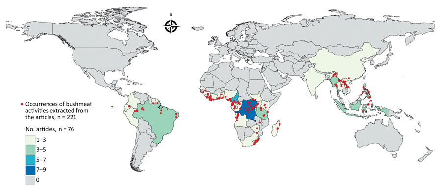
Figure 1. Geographic distribution of articles from the literature used to model a map of global bushmeat activities (hunting, preparing, and selling bushmeat) to improve zoonotic spillover surveillance. We extracted data from 76 articles. Red dots indicate occurrences of bushmeat activities (n = 221) in 38 countries, and colored shading indicated the number of articles extracted per country.
Page created: February 06, 2023
Page updated: March 20, 2023
Page reviewed: March 20, 2023
The conclusions, findings, and opinions expressed by authors contributing to this journal do not necessarily reflect the official position of the U.S. Department of Health and Human Services, the Public Health Service, the Centers for Disease Control and Prevention, or the authors' affiliated institutions. Use of trade names is for identification only and does not imply endorsement by any of the groups named above.