Epidemiologic and Genomic Reidentification of Yaws, Liberia
Joseph W.S. Timothy

, Mathew A. Beale, Emerson Rogers, Zeela Zaizay, Katherine E. Halliday, Tarnue Mulbah, Romeo K. Giddings, Stephen L. Walker, Nicholas R. Thomson, Karsor K. Kollie
1, Rachel L. Pullan
1, and Michael Marks
1
Author affiliations: London School of Hygiene and Tropical Medicine, London, UK (J.W.S. Timothy, K.E. Halliday, S.L. Walker, N.R. Thomson, R.L. Pullan, M. Marks); Wellcome Sanger Institute, Hinxton, UK (M.A. Beale, N.R. Thomson); Ministry of Health, Monrovia, Liberia (E. Rogers, Z. Zaizay, T. Mulbah, R.K. Giddings, K.K. Kollie); University College London Hospitals NHS Foundation Trust, London (S.L. Walker, M. Marks)
Main Article
Figure 2

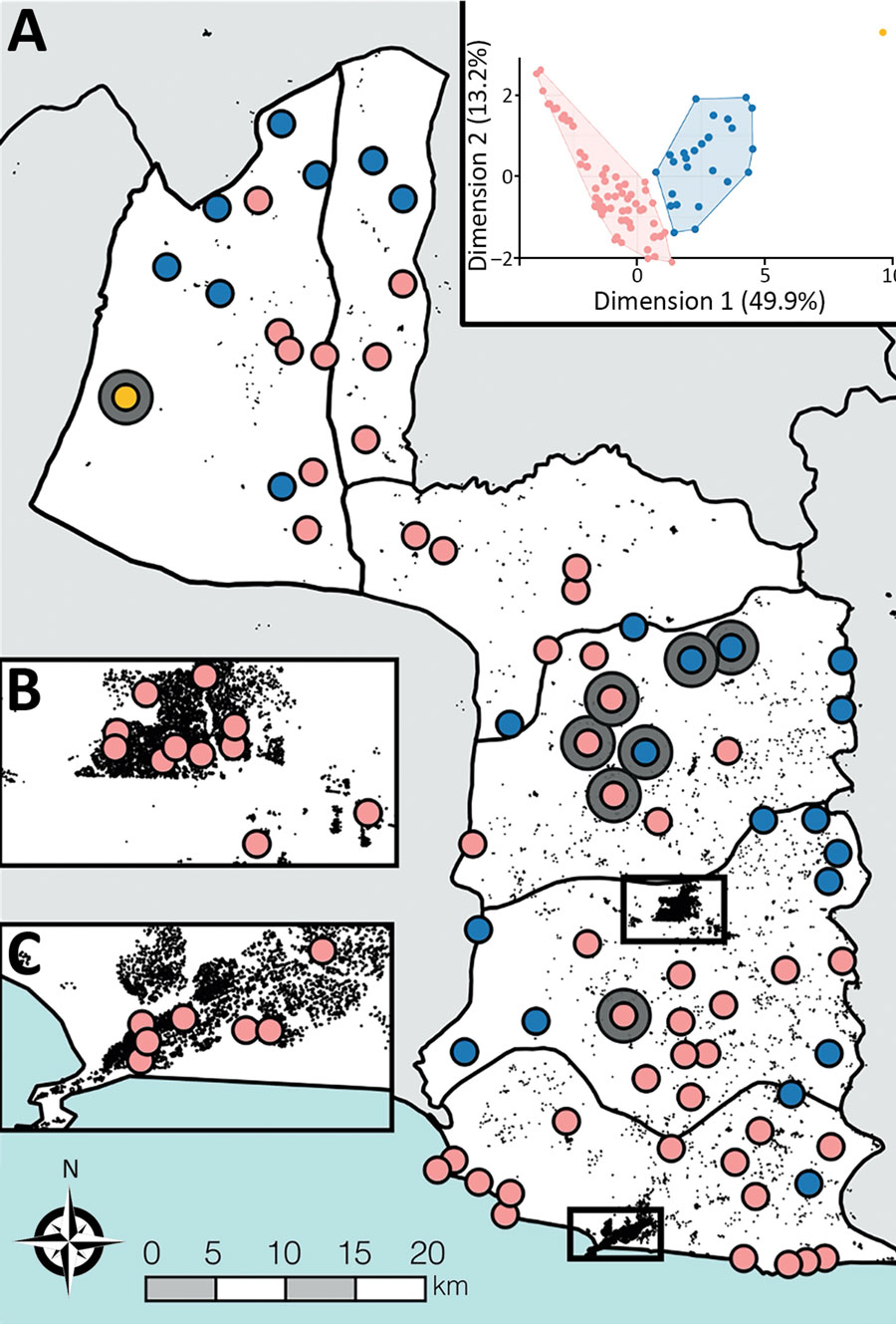
Figure 2. Spatial occurrence and accessibility of yaws endemic communities in Maryland County, Liberia. A) All survey cluster centroids (n = 92). Yaws endemic clusters are shown by large gray circles. All survey clusters were classified based on accessibility criteria into high access (pink), low access (blue), and very low access (yellow) using open-source GIS datasets. Black features are OpenStreetMap defined buildings (©OSM Contributors) to provide indication of structural density. B, C) Main urban centers of Maryland County: Pleebo (B) and Harper (C). Inset: Results of divisive hierarchical classification. The axes of this plot show the principal components and proportion of variance explained by each component.
Main Article
Page created: January 13, 2021
Page updated: March 18, 2021
Page reviewed: March 18, 2021
The conclusions, findings, and opinions expressed by authors contributing to this journal do not necessarily reflect the official position of the U.S. Department of Health and Human Services, the Public Health Service, the Centers for Disease Control and Prevention, or the authors' affiliated institutions. Use of trade names is for identification only and does not imply endorsement by any of the groups named above.
